In a simple definition, a City is an area of interconnection between people and numerous factors that govern our daily lives such as Housing, Transportation, Water, Wastewater, Climate…etc. We have long been worried about how to improve the existing infrastructure in our cities while planning properly for their growth.
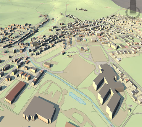
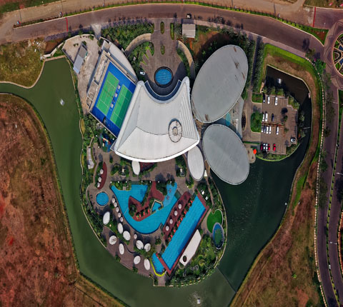
Mapping and GIS have long contributed to these efforts ensuring that the latest technologies have been deployed to facilitate the decision making process and provide accurate and up-to-date information to various stakeholders. The continuous improvements in GIS over the past 20 years are now allowing us to visualize our cities in a true 3D environment which will in turn allow us to better manage our cities. GIS is no longer 2D, but is now 3D. The fact that we are now capable of building 3D City Models in a GIS environment is going to allow numerous activities such as Cadaster, Public Safety, Traffic Control…etc. to take on other dimensions.


WHY 3D GIS? The real question should be “Why not 3D GIS”? Certainly our world is 3D and not 2D. Any simulation or decision we would want to take should be based on what our real world looks like. Although this seems to be natural, it is not as straightforward as one would think. Everything around us is in 3D. The world is definitely not flat. Everything is impacted by the third dimension. For example, the energy consumption in any city is directly linked to the shadows, airflow, sun reflection etc. Energy consumption is therefore directly linked to the heights of the buildings.
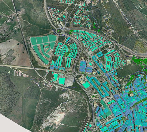
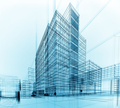
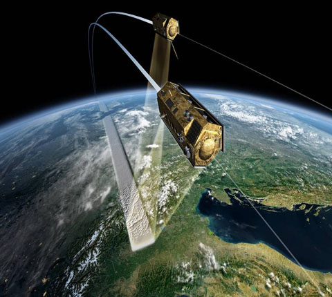
3D GIS: THE TECHNOLOGY : The CAD layering process was a breakthrough which many enjoyed but not for too long. The need for better analysis and the advancement in computers led to GIS (or 2D GIS). Because of the importance of the third dimension, we began including it in what was called 2.5D GIS in mid to late nineties. The advancement in Photogrammetry and production of digital Orthophotos as well as the wide availability of Satellite Imagery have given a boost to GIS to become more and more useful by larger communities.


3D GIS: THE DEPLOYMENT : 3D GIS Models have long been deployed by Google and Microsoft. These already offer tremendous content for users. However, in the commercial arena, we would need more “Intelligent” 3D Models. These would consist of a combination of spatial and non-spatial data using web-GIS platforms such as OnPoint. We would also need to have repositories for 3D data which would be designed to support analysis and integration of complex geospatially referenced data.
CONCLUSION : 3D City Models are a natural transition from the usual GIS. The advancement in technology allows their deployment and delivery to various users and stakeholders for various applications.3D City Models are the results of a fusion of several technologies such as Oblique Aerial Photography, Photogrammetry, LiDAR, Mobile Mapping…etc. Once they are built, they serve as the basis of an unimaginable amount of applications and simulations that can be made available to a large number of stakeholders.As technologies continue to advance, we should see that 3D City Models become more and more affordable, thus allowing a faster transition to 3D GIS.
rightclickorbit.com, one of the largest online repositories of maps since 2017, offers Geospatial services and products, specific to clients' requirements. RCO have a specialized team of cartographers, geographers, CAD designers, GIS experts and consultants, who provide GIS mapping services with quick turnarounds and accurate results.