Ensuring data accuracy is key to successful implementation as decisions are based on data from the database. Hence we ensure the accuracy during the field data collection and while creating it.
We undertake GPS, DGPS, Property and Utilities survey. We have successfully completed numerous projects across India. There is the presence of existing digital maps data for GIS use from public and private sources. The careful use of this data substantially reduces the time and cost involved during the GIS database development stage. We assist clients in finding appropriate existing data sources and compiling these varied data into a unified GIS database.

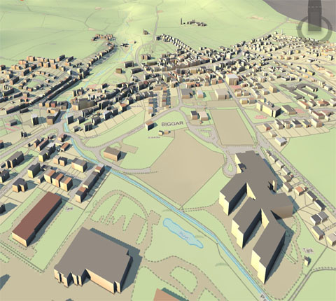
The core of any GIS technology solution is the geo-database. Our data services team has extensive experience in converting existing data to spatial data that meets the defined GIS business goals, using appropriate data conversion, migration and QA tools. We can create and organize Geo-databases and work with users to ingest these database services into “seamless” GIS geo-databases and geo-metadata that can form the back-bone of GIS solutions of any organization.
How GIS data is assessed, analyzed, cleansed, validated and maintained has a direct effect on the future success of your 9-1-1 operations. West can help you gain control of the increased demands for accurate spatial data, data management, quality assurance and maintenance of public safety GIS data. The West GIS team leverages proprietary processes and tools to proactively eliminate inaccurate information and build the foundational GIS data layers necessary for the appropriate emergency.


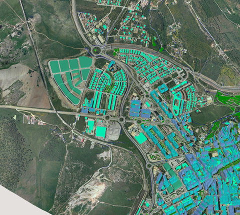
Capabilities : We have a very strong capabilities, whether it is ingest of maps generated from images, ingest of available paper-data - scanning paper drawings, maps, aerial photos or satellite images (handling data from a variety of sensors - WV-1, Geoeye-1, Landsat, SPOT, CARTOSAT-1 & 2, IKONOS, QuickBird) and creation of document archives and vectorising the scanned products, geo-tagging tabular databases of text/tables; documentation solutions etc.
The following data related services are offered : Once the data is geocoded, it can be enriched and analyzed, and this is where the actual value of the geocoding efforts are realized. With geocoding, you’ll be able to:
RCO expertise in data services enables us to provide strategic advisory aligned with your business needs. We will help you choose the right solution.
rightclickorbit.com, one of the largest online repositories of maps since 2017, offers Geospatial services and products, specific to clients' requirements. RCO have a specialized team of cartographers, geographers, CAD designers, GIS experts and consultants, who provide GIS mapping services with quick turnarounds and accurate results.